Slot Canyon Topography & Regions
Module 16
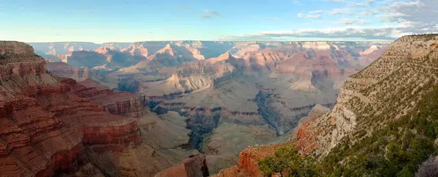
Most canyoneering in the United States is found on a topographic feature called the Colorado Plateau. This area is primarily located in southern Utah, west Colorado, north-west New Mexico, and the northern part of Arizona.
The Colorado Plateau encompasses the four-corner states and region of the Southwest part of the United States. From the NPS.gov website, it says, “Originally named by John Wesley Powell, the Colorado Plateau comprises a series of tablelands (plateaus or mesas) located within an immense basin surrounded by highlands. Stream valleys that are typically narrow and widely spaced dissect the region, as do larger valleys, including the most spectacular – the Grand Canyon. “
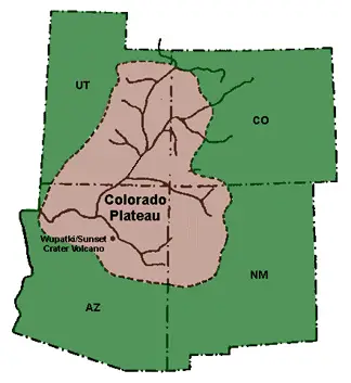
Colorado Plateau
Found in southern Utah, western Colorado, northwestern New Mexico, and northern Arizona
Contains one of the largest concentrations of slot canyons in the world
Features: Plateaus, mesas, narrow stream valleys, and iconic landmarks like the Grand Canyon
Utah: Canyoneering Mecca
Home to over 650 documented slot canyons, the highest concentration in the U.S.
Considered the “mecca” for slot canyoneering
Other Notable Regions
Arizona: Over 500 canyons, many slot canyons
California: Over 700 canyons, but few true slot canyons (primarily found in Death Valley)
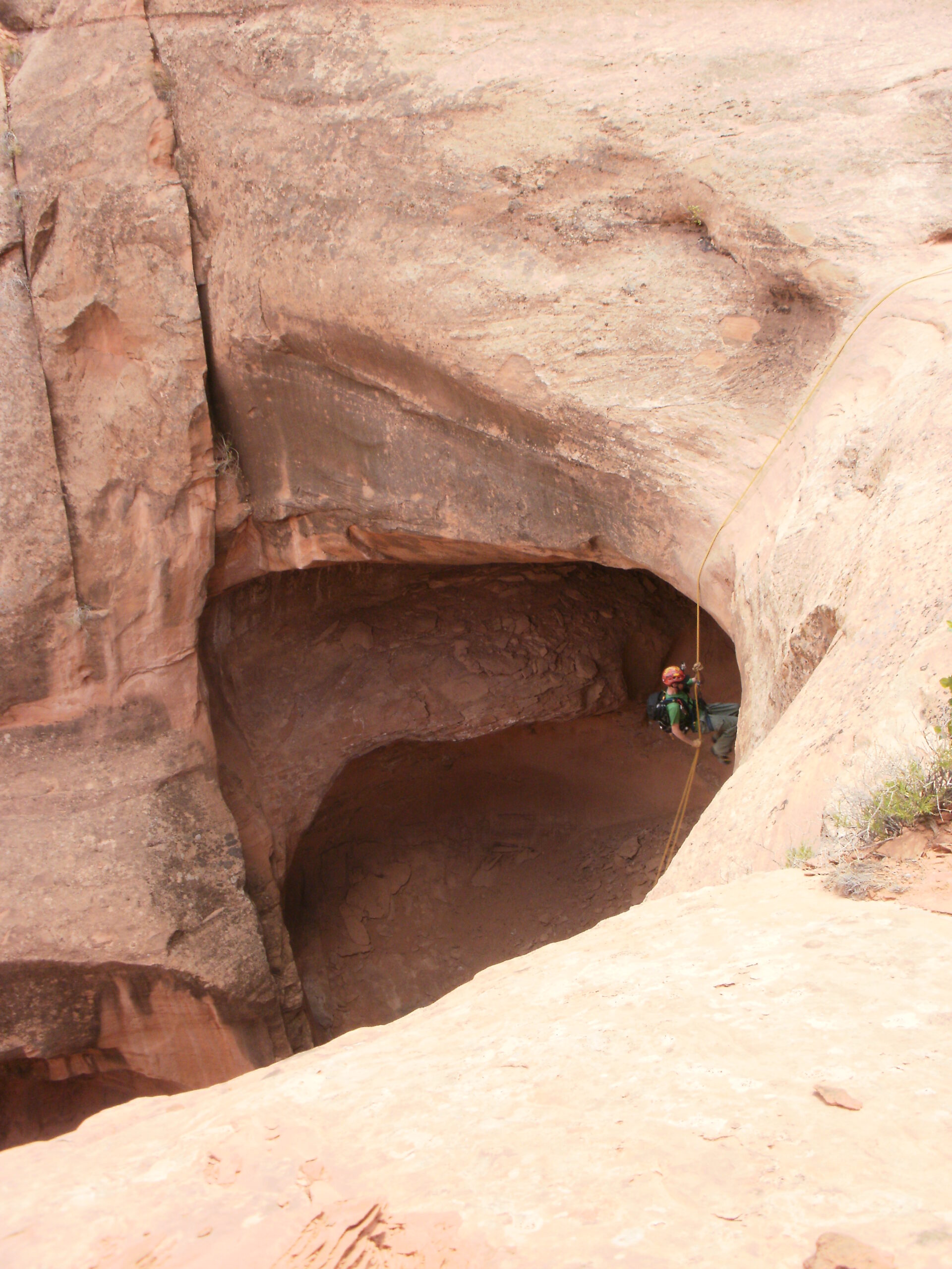
Canyons vs. “Routes”
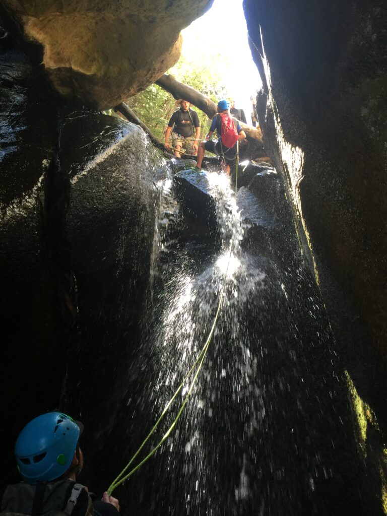
Canyons: Steep, narrow channels carved by water
Routes: Larger drainage areas with rappels, downclimbs, and tricky navigation
Both offer unique adventure opportunities, though routes may not involve true slot canyon experiences
Why Utah and Arizona?
Visitors flock to these areas for the chance to experience narrow, stunning slot canyon experiences
While “true” slots are uncommon in California, unique slot canyons in Death Valley NP exist
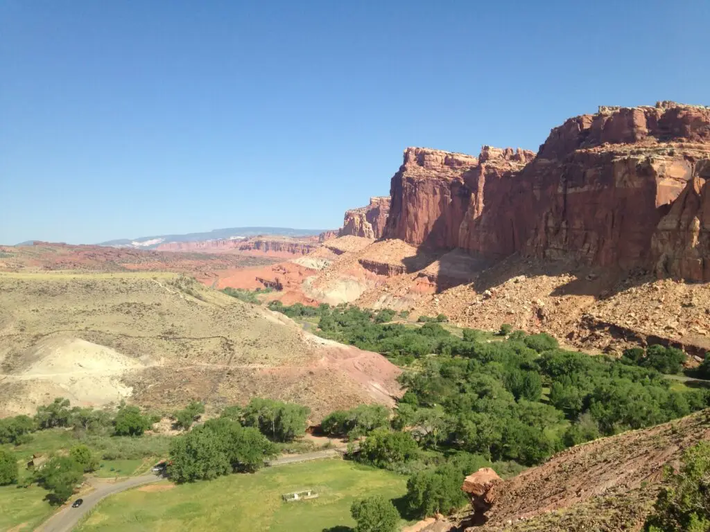
Capitol Reef (Utah):
To start, the correct spelling is “capitol” and not “capital”.
Location & Geology:
-
Located in south-central Utah, part of the Waterpocket Fold, a unique geological feature (monocline) stretching nearly 100 miles
-
Features layered geology, including Wingate and Navajo sandstone
Canyoneering:
-
Over 30 documented canyoneering routes along the Waterpocket Fold
-
Canyons primarily formed in sandstone, with rock types like shale, mudstone, gypsum, and limestone
Climate & Best Time to Visit:
-
Arid climate, with average summer highs around 90°F
-
Spring, summer, and fall are ideal; monsoon season (June-September) brings heavy rainfall and flash flood risks
Camping & Amenities:
-
Fruita offers the best camping with showers, toilets, shade from cottonwood trees, and grassy areas
-
Nearby Torrey has lodging and dining options
Popular Canyons:
-
Pandora’s Box
-
Cassidy Arch Canyon
-
The Wives
-
Cottonwood
-
Burro Wash
-
Near Lake Powell:
-
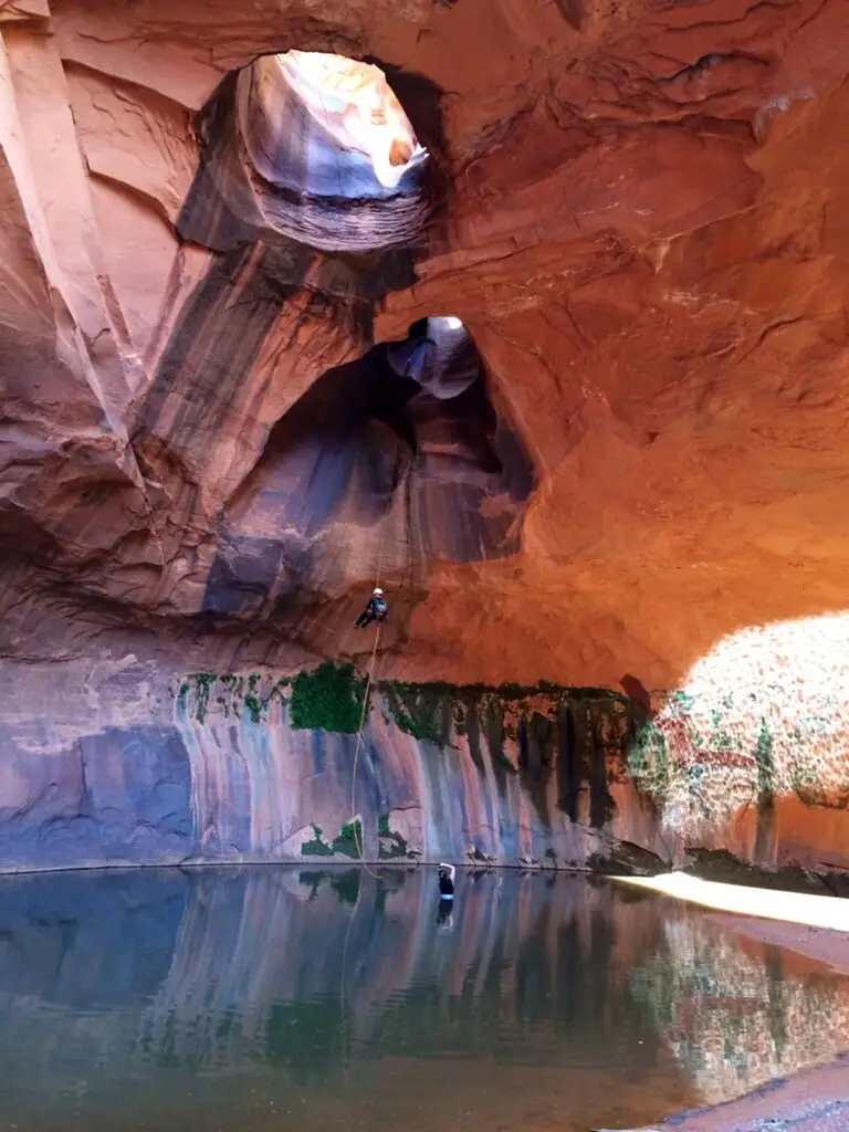
Poe/Smiling Cricket Canyon, with its iconic keeper pothole
-

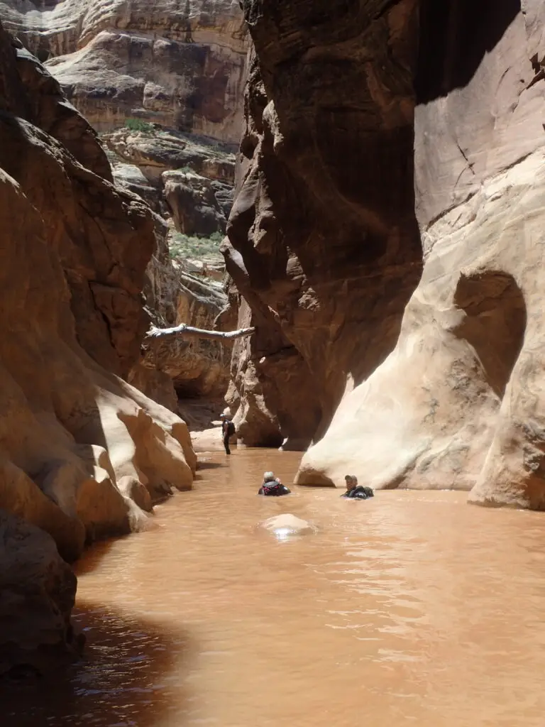
Cedar Mesa (Utah):
Location & Geology:
Located south of North Wash, near the Hite Bridge area at Lake Powell
Features bare rocks, high mesas, sheer cliffs, and deep canyons; Comb Ridge is a prominent topographic feature
Geology includes light-colored sandstone in the west, transitioning to gypsum, shale, and limestone in the east
Canyoneering:
Small concentration of technical slot canyons
Canyons typically contain water, so wetsuits are recommended year-round; Flash floods are a risk, with past fatalities
Climate & Best Time to Visit:
Best time to visit: Summer, as many canyons require water-based travel
Flash floods can occur (some have been deadly), so always check weather forecasts
Camping and Amenities:
Dispersed camping allowed on BLM land
Hite Marina and Hanksville (1 hour away) offer services
Bring all supplies (food, water, camping gear), as there are no nearby streams or creeks
Popular Canyons
Black Hole of White Canyon
Fry Canyon
Short Canyon
Cowboy Canyon
Cheesebox Canyon
Death Valley (California):
Location & Geology:
Features rugged, dry, remote terrain with limestone, siltstone, and sandstone
Crumbly rock formations; helmets required in canyons
Over 300 documented canyons; explored by Scott Swaney
Canyoneering:
Suitable for advanced canyoneers (long approaches, canyons, and exits); long rappels (often 200+ feet)
Natural anchors with significant webbing are essential
Helmets and self-sufficiency (water, gear) are critical due to rugged conditions; no reliable cell service
Climate & Best Time to Visit:
Extremely hot summers (average 105°F+); avoid in summer
Best time to visit: Fall, winter, and spring, when temperatures are cooler
Camping and Amenities:
Remote location with no convenience stores nearby; Self-sufficient camping is necessary
Bring plenty of water for strenuous hikes and canyon descents
Popular Canyons:
Greek Canyons: Styx, Hades, Deimos, Cerberus, Abysmal
Heart of Stone Canyon
Mosaic Canyon
Devil’s Canyon

Escalante (Utah):
Location & Geology
Located off the Hole-in-the-Rock Road, near Escalante, Utah
Primarily contain Navajo sandstone, with dolostone, gypsum, and limestone
Canyoneering
Intermediate/Advanced canyoneers only: challenging canyons with long approaches and exits
Keeper potholes and swimming required, especially after rainstorms
Solitude likely, except for Neon Canyon (popular);
Self-rescue is necessary; no cell service
Climate & Best Time to Visit
Best for Spring, Summer, and Fall; (Summer is hot and arid; but most canyons contain water)
Consider seasonal rainfall and its impact on water levels in canyons (especially in Choprock Canyon)
Camping and Amenities:
Dispersed camping is allowed on BLM land, but avoid camping at canyon entrances/exits
Water sources: Springs, seeps, and the Escalante River (can be silty; use pre-filters or gravity filters)
Nearest towns: Escalante and Boulder (about an hour from trailheads)
Popular Canyons:
Neon Canyon
Choprock Canyon
Zebra Canyon
Peekaboo
Micro Death Hollow
the Egypts
Grand Canyon (Arizona):
A relatively “new” area for canyoneers. This is for advanced canyoneers only as these canyons demand a lot in terms of days (most canyon adventures are multiple days…not just hours), energy, and water.
Location & Geology:
-
Located in the Grand Canyon National Park; (No formal canyoneering permits yet, but this may change in the future)
-
Canyons primarily formed in limestone, sandstone, and shale
-
The Colorado River plays a key role in most canyons’ access and exits; hauling and using a packraft is common
Canyoneering:
-
Not for beginners: long multi-day canyon adventures; 300+ foot rappels and carrying large amounts of rope and gear
-
Requires packrafts to navigate the Colorado River during canyon exits
-
Self-sufficiency is crucial; no cell service, carry rescue-satellite phones/devices
Climate & Best Time to Visit:
-
Winter: Preferred time for more favorable temperatures (avoid Summer due to extreme heat)
-
Spring and Fall: Good options but shorter daylight hours (may require hiking in the dark)
Camping and Amenities:
-
No cell service; rescue-satellite devices are highly recommended
-
The area is remote, requiring full self-sufficiency (water, gear, food)
Popular Canyons:
-
Deer Creek (currently closed)
-
Garden Creek
-
150 Mile Canyon
-
Whispering Falls
-
Panameta
-
Scotty’s Hollow
Moab (Utah):
Location & Geology:
Located in South-Eastern Utah, near Arches and Canyonlands National Parks
Known for sandstone formations; not primarily for slot canyons but offers many routes
Canyoneering:
Over 28 documented canyons in the area, mostly easy and short; Few canyons may require swimming or wading
Suitable for beginners, with many opportunities to practice rappelling skills
Canyons are generally not technically difficult, but crowds can be an issue on weekends
Climate & Best Time to Visit:
Summer: Peak season, but can be crowded
Spring and Fall: Ideal for good weather and fewer crowds
Camping and Amenities:
Moab offers plentiful lodging and food options
The area is close to multiple outdoor recreation opportunities (hiking, rock climbing, mountain biking, 4-wheeling)
Popular Canyons:
U-turn
Tierdrop
Dragonfly
Granary
Pleiades
Rock of Ages
MMI
Undercover Canyon
North-Wash (Utah):
Location & Geology:
Located north of Hite Marina, near Lake Powell
Contains over 42 documented canyons, many of which are tight slot canyons
Canyoneering:
Physically demanding canyons, even short routes can be exhausting
Rappels are not particularly high but require problem-solving and strength
Some canyons are especially challenging for larger individuals (Middle Leprechaun Canyon is particularly tough)
Minimal water in the canyons year-round, though snow conditions can create unique winter challenges
Climate & Best Time to Visit:
Spring and Fall: Popular seasons, though crowded (Winter: Cold, with potential snow conditions in the canyons)
Camping and Amenities:
Main campground: Sandthrax Campground (often crowded, no on-site bathrooms or water); bring water (5-gallon containers)
Hog Springs rest stop has a port-a-potty, about 10-minute drive from the canyon and Sandthrax Campground
Nearest services: Hanksville (35-45 mins away) and Hite Marina (30-45 mins away)
Popular Canyons:
Hogwarts
Morocco
Irish Canyons (Shillelagh, Blarney, Leprechaun)
The Hogs (1-4)
Shenanigans
Woody Canyons
Robbers Roost (Utah):
Location & Geology:
Located southeast of the San Rafael Swell, west of Canyonlands N.P., and north of North Wash
Name originates from outlaws like Butch Cassidy using it as a hideout in the 1800s along the Outlaw Trail
Canyoneering:
Features tight slot canyons similar to North Wash (Some canyons can be difficult for larger canyoneers)
Minimal water in most canyons, though some may have puddles
Protection for forearms and knees recommended due to abrasion from narrow canyons
Climate & Best Time to Visit:
Best visited year-round, except summer (hot with little shade and little water)
Avoid if rain is in the forecast, as roads can become impassable (Flash floods are concern during June to September)
Camping and Amenities:
BLM land offers ample dispersed camping
“Motel 6” campsite: Popular, often full on weekends
Nearest services: Hanksville (30-60 minutes away)
Popular Canyons:
Blue John
Alcatraz
Larry
Chambers
Mindbender Canyons
Poison Spring Canyons
Angel Canyons (Fallen Angel, Lost Angel, Angel Cove)
Spur Canyons (Red, High, Low)
White Roost
San Rafael Swell (Utah):
Location & Geology:
Located in southern-central Utah, part of the Colorado Plateau; Geologically unique as an anticline (fold)
The San Rafael Reef surrounds the Swell, with jagged cliffs and deep canyons
Common rock types: Navajo & Wingate sandstones, mudstone, and limestone
Canyoneering:
Canyons feature potholes that can vary in depth after rainfall (may shift from shallow to fully submerged)
Skill level: Ranges from beginner to intermediate, with challenges like keeper potholes and partner assists or bag tosses required for escapes
Wetsuits recommended even on the hottest days
Climate & Best Time to Visit:
Barren desert environment,
Best visited in cooler months or summer heat (Wetsuits common; even in summer heat)
Camping and Amenities:
BLM land provides dispersed camping options
Water: Carry all supplies, as there are few natural springs; recommended to bring 5-gallon containers
Nearest towns: Green River and Hanksville (30 to 90 minutes away), offering limited services and eateries
Popular Canyons:
Knotted Rope
Quandary
The Squeeze
Goblin’s Lair (Chamber of the Basilisk)
Eardley
Zero Gravity
Baptist Draw
Non-technical canyons:
Little Wild Horse Canyon and Bell Canyon loop
Ding and Dang Canyon loop
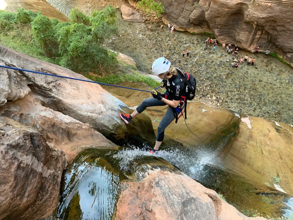
Zion National Park (Utah):
Location & Overview:
Refers to both Zion National Park and surrounding areas (including parts of St. George, over an hour away)
Most frequented canyoneering destination in Utah with 55+ documented canyons
Canyoneering:
Canyons range from beginner to expert levels, with 1-30 rappels and heights from 10 to 400 feet
Rangers enforce strict permit compliance; violations can result in citations, mandatory court appearances, and fines
Wetsuits recommended for swimming canyons, especially in Spring, Summer, and Fall (except on the hottest days)
Flash floods and rappelling accidents are a serious risk, particularly during monsoon season
Climate & Best Time to Visit:
Best times: Spring, Summer, Fall (Beware during late summer: monsoon season – risk of flash floods)
Wetsuits advisable for most canyons (check conditions in advance)
Camping & Amenities:
Zion is surrounded by full-service towns (Springdale, St. George), with lodging, gas, food, and amenities available
Crowds are common, especially during peak seasons—plan ahead!
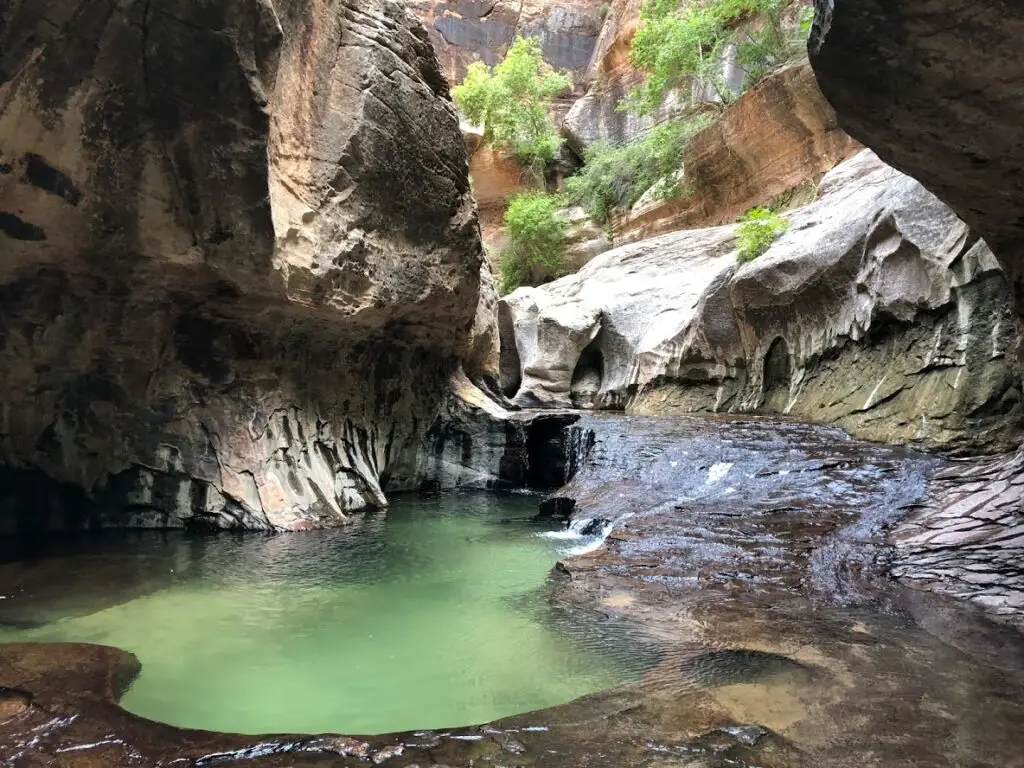
Popular Canyons:
Subway
Keyhole
Heaps
Imlay
Kolob
Pine Creek
Spry
Mystery
Echo
Birch Hollow
Behunin
Englestead
Orderville Gulch
Fat Man’s Misery (West)
Johnson Arch Canyon
Diana’s Throne