
IN THIS MODULE
16 Canyon Topography & Regions (Utah)
Much of the best-known U.S. desert and slot-canyon canyoneering is concentrated on the Colorado Plateau, a huge high-desert region covering parts of southern Utah, western Colorado, northwestern New Mexico, and northern Arizona.
The Plateau is made up of plateaus, mesas, cliffs, narrow valleys with small streams, and deep drainages. It also contains one of the greatest concentrations of slot-canyon terrain in the world—which is a big reason Utah has become such a canyoneering “mecca”.

The Colorado Plateau and the Four Corners region
COLORADO PLATEAU
• Southern Utah, western Colorado, northwestern New Mexico, and northern Arizona.
• One of the largest concentrations of slot-canyon terrain in the world, with hundreds and hundreds of documented canyons and routes in Utah alone.
• Plateaus, mesas, narrow stream valleys, and major canyon systems define the landscape.
CANYONS VS. “ROUTES”
• Canyons: steep, narrow channels carved by water.
• Routes: larger drainage adventures that may include rappels, downclimbs, and navigation without a true “slot” for the entire trip.
• Both can make excellent canyoneering adventures.
UTAH REGION PROFILE
Capitol Reef and Waterpocket Fold


LOCATION & GEOLOGY
• South-central Utah along the Waterpocket Fold, a monocline stretching nearly 100 miles.
• Layered geology includes Wingate and Navajo sandstone.
CANYONEERING
• Many documented routes are found along and around the Waterpocket Fold.
• Sandstone is a majority of the rock concentration, with shale, mudstone, gypsum, and limestone also present.
CLIMATE / TIMING
• Arid climate; summer highs around 90°F.
• Check heat, snowmelt, and thunderstorms; season alone does not establish suitability.
CAMPING / AMENITIES
• Fruita is the main developed camping area, with shade, grass, toilets, and services.
• Torrey provides nearby lodging and dining.
POPULAR CANYONS (Difficulty varies):
• Pandora's Box
• Cassidy Arch Canyon
• Sulphur Creek
• The Wives
• Rotary Dial Canyon
• Burro Wash
• Red Canyon (Sunglow)
OPTIONS TO DISCUSS WITH A LEADER:
• Wife 3
• Wife 5
• Cassidy Arch Canyon
• Stegosaur Slot
• Red Canyon (Sunglow)
• Watson Canyon
• Grand Wash
UTAH REGION PROFILE
Cedar Mesa and Southeast Utah


LOCATION & GEOLOGY
• South of North Wash near the Hite Bridge / Lake Powell area.
• Bare rock, high mesas, sheer cliffs, deep canyons, and Comb Ridge are prominent features.
CANYONEERING
• A smaller concentration of technical slot canyons.
• Water is common enough that wetsuits are often recommended; flash floods have caused fatalities.
CLIMATE / TIMING
• Wet routes can remain cold in summer. Heat, thunderstorms, and flash floods still control the decision.
• Always evaluate flash-flood potential and current conditions.
CAMPING / AMENITIES
• Dispersed camping is available on BLM land.
• Hite currently has no visitor services. Verify current NPS access/conditions before relying on the Hite area; Hanksville and Blanding are more dependable resupply options. Carry your own food, water, and camping supplies.
POPULAR CANYONS (Difficulty varies):
• Black Hole of White Canyon
• Cheesebox Canyon
• Gravel Canyon
• Fry Canyon (Cedar Mesa)
• Duckett Slot
• Short Canyon
• Cowboy Canyon
• Scar Tissue
OPTIONS TO DISCUSS WITH A LEADER:
• Duckett Slot
• Fry Canyon (Cedar Mesa)
• Short Canyon
• Dhalgren Canyon
• Scar Tissue
• Alcove Amble Canyon
UTAH REGION PROFILE
Grand Staircase Escalante


LOCATION & GEOLOGY
• Centered around the Hole-in-the-Rock Road near Escalante, Utah.
• Navajo sandstone dominates, with dolostone, gypsum, and limestone also present.
CANYONEERING
• Many routes are better suited to intermediate or advanced groups because approaches and exits can be long.
• Keeper potholes and swims are common in some canyons, and solitude is normal away from popular routes.
CLIMATE / TIMING
• Plan around heat, cold water, thunderstorms, and road conditions rather than a season label.
• Seasonal rainfall and water levels can strongly affect routes, especially canyons such as Choprock.
CAMPING / AMENITIES
• Dispersed camping is common on BLM land; avoid canyon entrances and exits.
• Escalante and Boulder are the nearest towns; springs, seeps, and the silty Escalante River may be encountered.
POPULAR CANYONS (Difficulty varies):
• Choprock Canyon (South Fork)
• Neon Canyon
• Coyote Gulch
• Egypt 1 Canyon
• Egypt 3
• Peek-a-Boo Canyon
• Spooky Gulch
• Zebra Canyon
• Buckskin Gulch (Paria region, outside Escalante)
• Ringtail Canyon
OPTIONS TO DISCUSS WITH A LEADER:
• Egypt 1 Canyon
• Egypt 3
• Peek-a-Boo Canyon
• Spooky Gulch
• Zebra Canyon
• Dry Fork Slot
• Wire Pass (Paria region, outside Escalante)
• Dunham Slot
• Willis Creek Narrows
• Bull Valley Gorge
UTAH REGION PROFILE
Moab and Canyonlands


LOCATION & GEOLOGY
• Southeastern Utah near Arches and Canyonlands National Parks.
• Famous sandstone terrain, although many routes are not classic tight slot canyons.
CANYONEERING
• The Moab area contains many documented canyoneering routes, including a number of relatively short descents.
• Some routes include wading or swimming; the area provides many opportunities to practice rappelling skills.
CLIMATE / TIMING
• Spring and fall are highlighted for comfortable weather.
• Summer can be very hot and weekends can be crowded.
CAMPING / AMENITIES
• Moab has extensive lodging, food, fuel, and other services.
• The same area also supports hiking, climbing, mountain biking, and four-wheeling.
POPULAR CANYONS (Difficulty varies):
• U-Turn Canyon
• Medieval Chamber
• Lomatium Canyon
• Pleiades Canyon
• Dragonfly Canyon
• Granary Canyon
• Elephant Butte
• Entrajo Canyon
• Big Horn Canyon
• Bow and Arrow
• Fins and Things Canyon
OPTIONS TO DISCUSS WITH A LEADER:
• U-Turn Canyon
• Bow and Arrow
• Repeat Jr
• Medieval Chamber
• Moonflower Canyon
• Tierdrop Canyon
• Not Tierdrop Canyon
• Fins and Things Canyon
• Winter Camp Slot
UTAH REGION PROFILE
North Wash and Lake Powell


LOCATION & GEOLOGY
• South of Hanksville along State Route 95 toward Hite and Lake Powell.
• North Wash contains many documented routes, including very narrow/tight slot canyons.
CANYONEERING
• Even short routes can be physically demanding.
• Rappels are often not extremely high, but movement, squeezes, and problem-solving can take a lot of energy.
CLIMATE / TIMING
• Spring and fall are popular; winter can bring snow and cold conditions.
• Water is generally limited compared with wetter regions.
CAMPING / AMENITIES
• Sandthrax Campground is a common base but has very limited facilities; bring water.
• Hog Springs has a rest area; Hanksville is the primary nearby service town. Hite currently has no visitor services, so verify NPS conditions before relying on that area.
POPULAR CANYONS (Difficulty varies):
• Shenanigans
• Hard Day Harvey Canyon
• Montezuma Canyon
• Trachyotomy Canyon
• Sandthrax Canyon
• Hogwarts Canyon
• No Kidding
• Morocco Canyon
• Leprechaun Canyon (Middle Fork)
• Blarney Canyon (Left Fork)
• Hog 1 Canyon (Boss Hog)
• Paradiso Canyon
OPTIONS TO DISCUSS WITH A LEADER:
• Blarney Canyon (Left Fork)
• Blarney Canyon (Right Fork)
• Shillelagh (East Fork)
• Hogwarts Canyon
• Woodsy Canyon
• Leprechaun Canyon (East Fork)
• Leprechaun Canyon (West Fork)
• Morocco Canyon
• Hog 1 Canyon (Boss Hog)
• Maidenwater (Upper Middle Fork)
UTAH REGION PROFILE
Robbers Roost and Dirty Devil

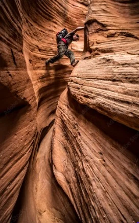
LOCATION & GEOLOGY
• Southeast of the San Rafael Swell, west of Canyonlands, and north of North Wash.
• The region is historically associated with outlaws such as Butch Cassidy.
CANYONEERING
• Tight slots can feel similar to North Wash and may be difficult for larger canyoneers.
• Most routes are fairly dry; forearm and knee protection can help in abrasive narrows.
CLIMATE / TIMING
• Avoid the hottest summer conditions.
• Rain can make roads impassable, and flash floods remain a concern during monsoon season.
CAMPING / AMENITIES
• BLM land provides dispersed camping.
• The “Motel 6” campsite is a popular base; Hanksville is generally the nearest service town.
POPULAR CANYONS (Difficulty varies):
• Alcatraz Canyon
• Larry Canyon
• Chambers Canyon
• High Spur Canyon
• Bluejohn Canyon (Squeeze Fork)
• Big Spring Canyon (Northwest Fork)
• White Roost Canyon (Main Fork)
• Slideanide Canyon
• Arscenic Canyon
• Horseshoe Canyon
• Burrly Canyon
OPTIONS TO DISCUSS WITH A LEADER:
• White Roost Canyon (West Fork)
• White Roost Canyon (Main Fork)
• Big Spring Canyon (Northwest Fork)
• Angel Slot
• Angel Cove (Main Fork)
• Bluejohn Canyon (West Fork)
• Bluejohn Canyon (Little West Fork)
• Bull Pasture Canyon
• Pasture Canyon
• Arscenic Canyon
UTAH REGION PROFILE
San Rafael Swell


LOCATION & GEOLOGY
• South-central Utah on the Colorado Plateau.
• The Swell is an anticline surrounded by the San Rafael Reef; Navajo and Wingate sandstone, mudstone, and limestone are common.
CANYONEERING
• Potholes can change dramatically after rainfall—from shallow to fully submerged.
• Routes range from nontechnical hikes to advanced descents with keeper potholes, complex rope work, or serious water hazards.
CLIMATE / TIMING
• A barren desert environment where temperature and water both matter.
• Wetsuits may be useful even during hot weather depending on the route and water.
CAMPING / AMENITIES
• BLM land provides dispersed camping.
• Carry water; Green River and Hanksville provide the nearest limited services.
POPULAR CANYONS (Difficulty varies):
• The Squeeze
• Quandary Canyon
• Baptist Draw
• Zero G Canyon
• Knotted Rope Canyon
• Black Box (Upper)
• Goblin's Lair
• Little Wild Horse Canyon
• Eardley Canyon (Lower)
• Ding Canyon
• Dang Canyon
OPTIONS TO DISCUSS WITH A LEADER:
• Little Wild Horse Canyon
• Goblin's Lair
• Ding Canyon
• Dang Canyon
• Crack Canyon
• Wild Horse Window Canyon
• Box and Double Arch Canyons
• Lupacchiotta Canyon
• Upper Black Dragon Wash
• Baptist Draw
UTAH REGION PROFILE
Zion and Southwest Utah


LOCATION & OVERVIEW
• Includes Zion National Park and surrounding canyon country, including areas toward St. George.
• Zion and the surrounding area contain many well-documented technical canyon routes and are among the best-known canyoneering destinations in the United States.
CANYONEERING
• Routes range from relatively straightforward trade canyons to advanced-expert descents with multiple rappels, complex movement, cold water, and substantial vertical drops.
• Zion requires Wilderness permits for technical canyoneering trips; wet canyons commonly require thermal protection. Verify current permits, closures, and conditions before the trip.
CLIMATE / TIMING
• Spring, summer, and fall are common seasons; late-summer monsoon weather increases flash-flood concerns.
• Conditions vary widely, so wetsuit needs should be checked route by route.
CAMPING / AMENITIES
• Springdale and St. George provide extensive lodging, food, fuel, and services.
• Crowds are common during peak periods, so planning ahead matters.
POPULAR CANYONS (Difficulty varies):
• Heaps Canyon
• Imlay Canyon (Full)
• Kolob Canyon
• Pine Creek Canyon
• The Subway
• Mystery Canyon
• Keyhole Canyon (Zion National Park)
• Behunin Canyon
• Englestead Hollow
• Spry Canyon
• Echo Canyon (Middle)
OPTIONS TO DISCUSS WITH A LEADER:
• Keyhole Canyon (Zion National Park)
• Orderville Canyon
• Zion Narrows (Lower)
• Minaret Canyon
• Diana's Throne Canyon
• Yankee Doodle Hollow
• Red Caves
• Jolley Gulch